- Things To Do
- Events
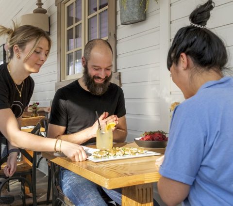
- Food & Drink
-
Places To Go
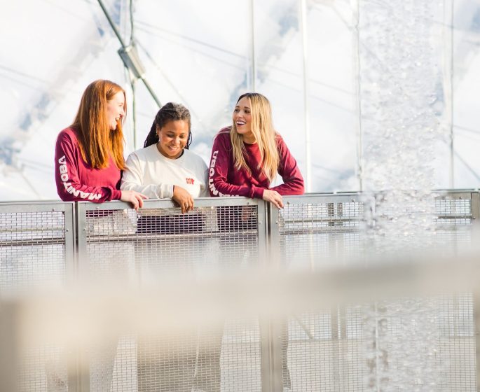
- Winnipeg
- Churchill
- Eastern Region
- Central Region
- Interlake Region
- Parkland Region
- Western Region
- Manitoba North
- Must-See Destinations
-
Itineraries
- Island Getaway on the Prairies
- Wheat City Wanderings in Brandon
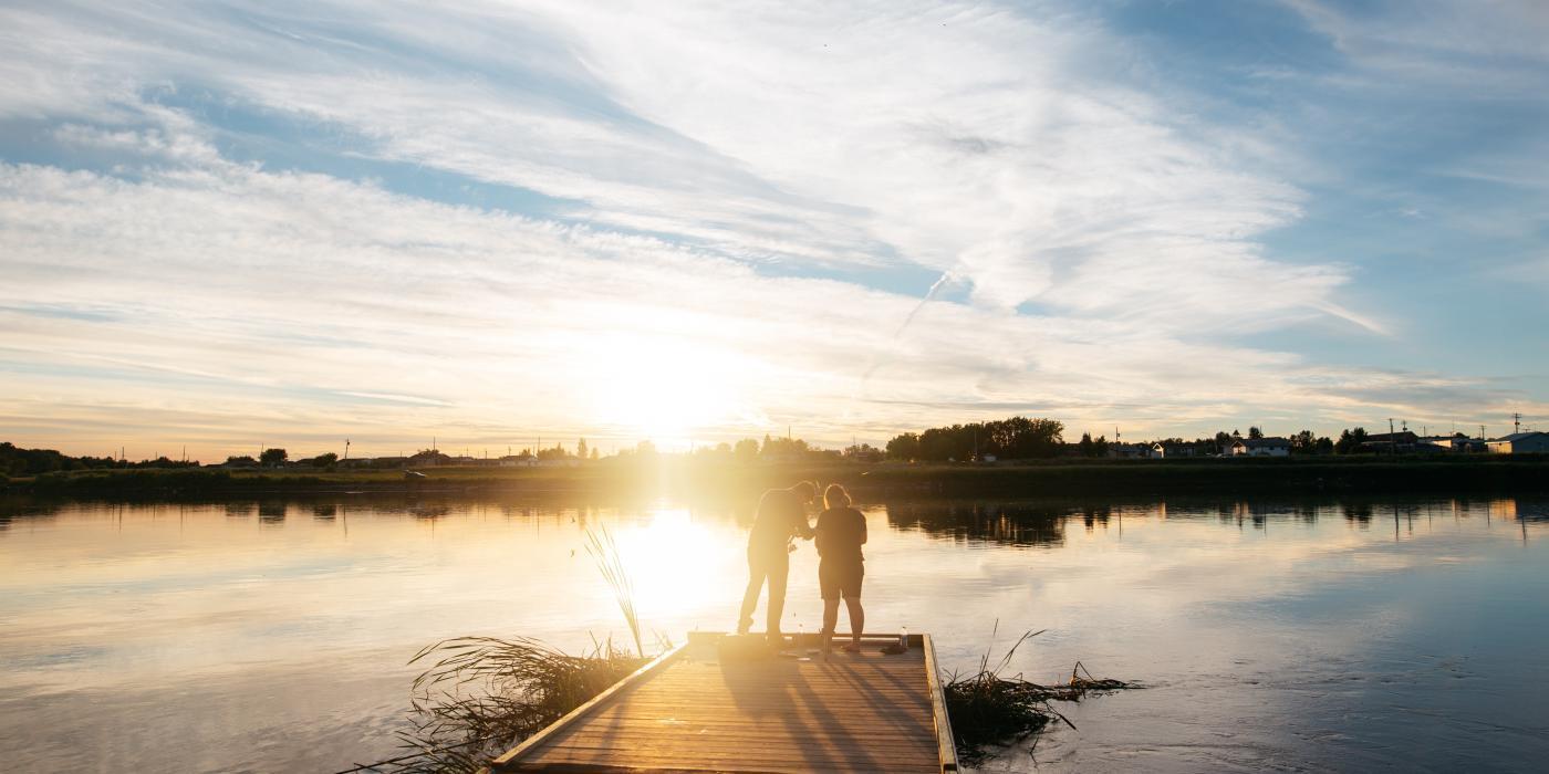
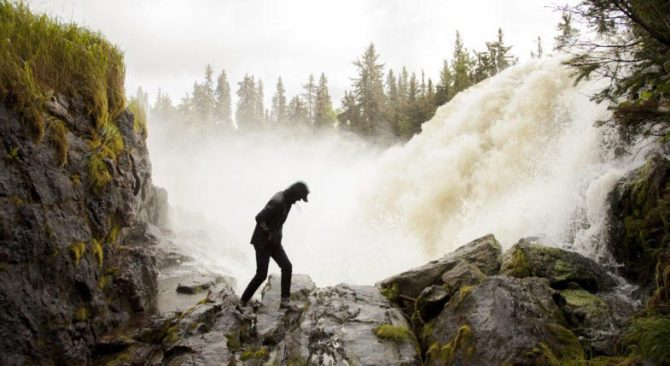
- Escape to the water and the wild
- St. Boniface Winter: Passion and History
- Follow the path to a story in Neepawa
- Unleash your inner Viking this winter
- Explore Clear Lake this winter like never before
- Breathe in the Whiteshell this winter
- Go North for a boreal forest escape
- Treaty Areas
- Where To Stay
- Trip Essentials
- #ExploreMB Blog
Explore Winter In Manitoba

Travel Manitoba
Urban Escapes
Whether you seek a change of scenery, pace, or perspective, Winnipeg, the capital city of Manitoba, invites you to...
More Info

Elkhorn Resort
Stunning Stays
Use this page as your guide to discovering the most stunning accommodations that Manitoba has to offer.
More Info


Handcraft Courtesy of Travel Manitoba
Road Trips
Whether you're drawn to the cultural tapestry of urban centers or the serene landscapes of Manitoba's wilderness, a...
More Info
Manitoba Experiences


Cody Fjeldsted
Manitoba Gear
Wear Canada’s heart on your sleeve
Show the world that you found what your heart needs in Manitoba. Whether it's to remember your visit, show off your local pride or just keep warm on your next adventure, visit our online shop to browse a range of toques, mitts, shirts, sweaters and more.
Featured Experiences

Arrowhead RV Park
Winnipeg's Top Rated RV Park
Nestled on the prairies, Arrowhead RV Park is an ideal resting spot to recharge during your travels. 30&50 Amp FHU, coin laundry, park-wide Internet($), clean/modern restrooms/showers, info centre, rv rental, service français.

Interlake Tourism Association
5 Must-Visit Summer Havens for Interlake
Are you craving an unforgettable summer escape? Add these 5 destinations to your itinerary and you will see why summers are always epic in the Interlake!

Canadian Fossil Discovery Centre
Fossil Dig Tours
Book you Dig Tour Adventure this spring with the Canadian Fossil Discovery Centre! Become a Palaeontologist for a day with us to excavate fossil marine giant reptiles at the Manitoba Escarpment.

Canadian Museum for Human Rights
Blockbuster Exhibit Goes Beyond The Beat
Beyond the Beat; Music of Resistance and Change – now at the Canadian Museum for Human Rights – goes beyond sound, sharing stories of how musicians of all kinds have used music to make social change. Visit this summer!

Calm Air International LP
Book your next MB trip with Calm Air
Discover the serene skies with Calm Air – your gateway to Winnipeg, Flin Flon, The Pas, Thompson, or Churchill. Plan your next trip and book now for a stress-free journey into the heart of Manitoba's beauty.

Delta Winnipeg
Winnipeg's Largest Full Service Hotel
Delta Hotels Winnipeg provides nothing short of streamlined, comfortable accommodations. Attached to the RBC Convention Centre and Canada Life Centre. Large indoor and outdoor pool. Amazing food and beverage offerings.

Thermea by Nordik
The ultimate wellness experience
Discover Winnipeg's only thermotherapy spa: Thermëa by Nordik Spa-Nature. This haven of wellness features multiple saunas, baths, and rest areas, plus a seasonal Biërgarden with must-try wood-fired pizza and craft beers.
Explore Manitoba

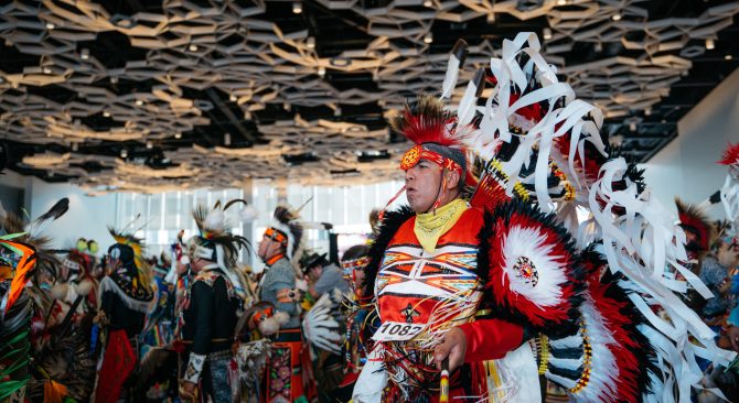
Indigenous Tourism Association of Canada
Destination Indigenous
Experience Manitoba with the Indigenous Peoples who have called these lands home for millennia.
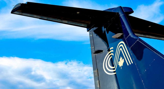
Calm Air
Official Air Carrier to the North
Calm Air partners with local operators to bring visitors to Churchill for the most authentic Northern experiences available today.
Places To Go
Manitoba's Must-See Destinations
These must-see destinations deliver the best of our province. Discover some of Manitoba’s favourite places to visit!